
Campgrounds
358 campgrounds
Lowman Fishing Ponds
Lowman Fishing Ponds is a day use area along the North Fork of the Payette River. I have included it as a review beca...
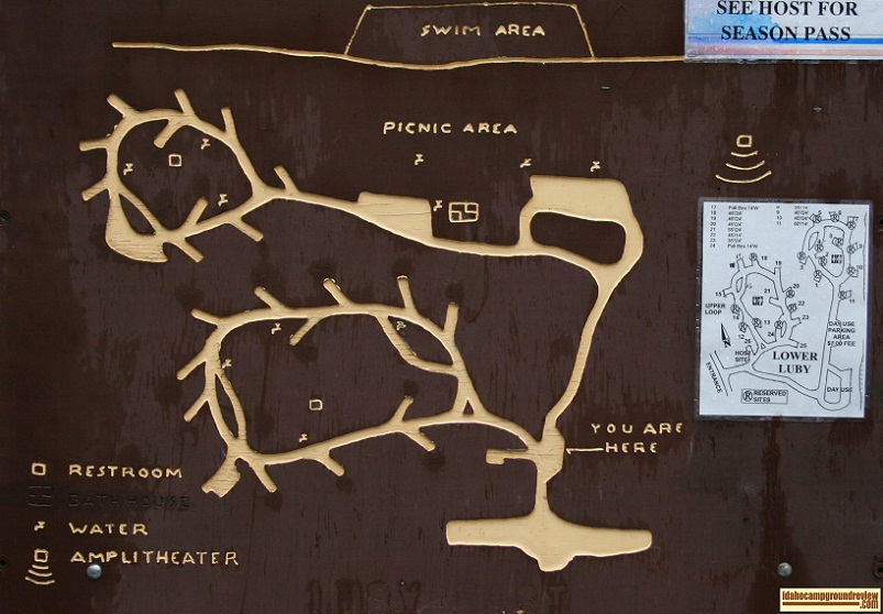
Luby Bay Campground
Luby Bay Campground is divided into Upper Luby Bay Campground and Lower Luby Bay Campground. They are situated on the...
Lud Drexler Park - BLM
Lud Drexler Park is a BLM facility on Salmon Falls Creek Reservoir. It offers camping for fishermen and a boat launch...
Macks Creek Campground
Macks Creek Campground and Picnic Area are located on Forest Service Road 268/Arrowrock Road just 4.5 miles from High...
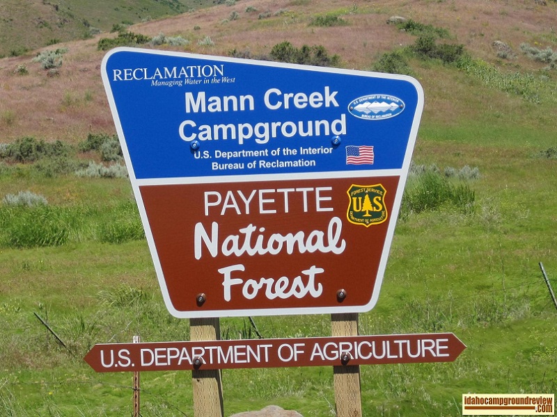
Mann Creek Campground
Mann Creek Campground is situated on Mann Creek near the northern end on Mann Creek Reservoir. The elevation is about...
Marsh Creek Campground
Marsh Creek Campground is located above Marsh Creek in the Frank Church River of No Return Wilderness Area about 22 m...
Martin Landing
Martin Landing encompasses 60 acres and is located at the confluence of the Boise, Owyhee and Snake Rivers. There are...
McCormick Park
McCormick Park is an Idaho Power recreational facility located on the Snake River just below Brownlee Dam. It was bui...
McCoy Creek Campground
McCoy Creek Campground sets on a hill on the southeast shore of Palisades Reservoir. It is divided into two sections....
McCrea Bridge Campground
McCrea Bridge Campground is situated along Henry's Fork of the Snake River. Like nearby Upper Coffee Pot, the area is...
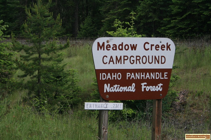
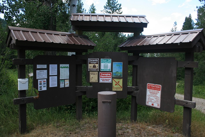
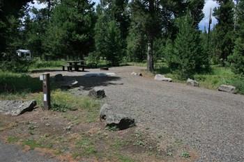
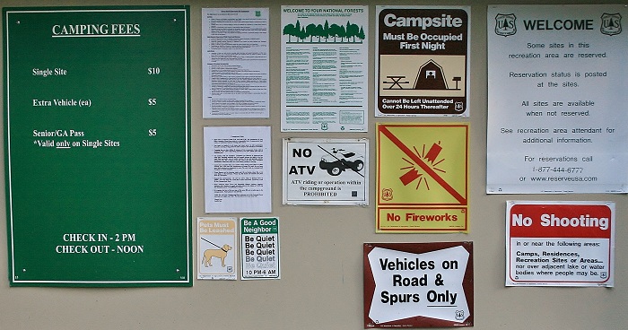
Meadow Creek Campground
Meadow Creek Campground is located in the Kaniksu National Forest (or Idaho Panhandle National Forest). The area is h...
Mike Harris Campground
Mike Harris Campground is set in rolling, heavily forested hills just off Highway 33 south of Victor, Idaho. We misse...
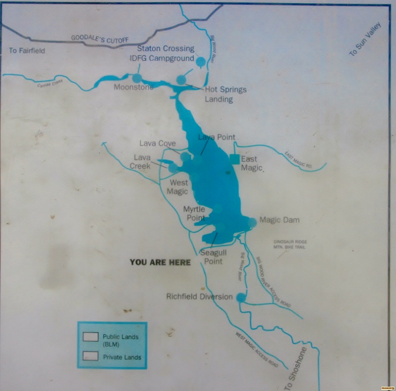
Moonstone Access Camping
Moonstone Access is situated on the north shore of Magic Reservoir, north of Twin Falls, Idaho. The country is covere...
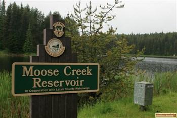
Moose Creek Reservoir Campgrounds
Moose Creek Reservoir is surrounded by gently rolling hills in Northern Idaho. The country is heavily forested with p...
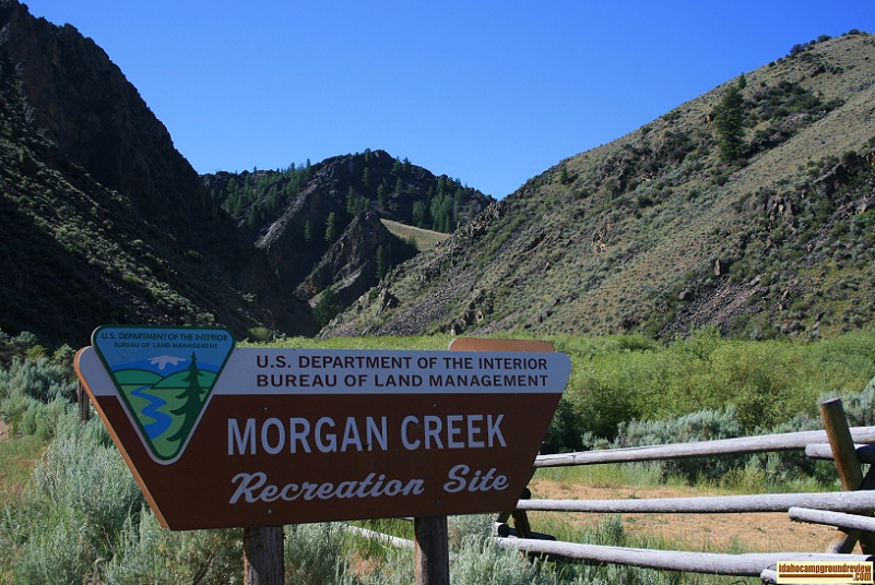
Morgan Creek Recreation Site
Morgan Creek Recreation Site is on Morgan Creek, due north of Challis, Idaho. The campground is on Morgan Creek wher...
Mormon Bend Campground
Mormon Bend Campground is set along the Salmon River on Hwy 75 between Stanley and Challis, Idaho. The river is down ...
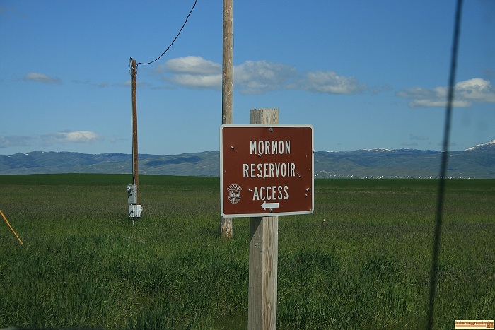
Mormon Reservoir Camping
Mormon Reservoir is a few miles south of Fairfield, Idaho, surrounded by sagebrush covered hills. I could not find th...
Mountain View Campgoround
Mountain View Campground is very close to Lowman, Idaho, on flat land between Highway 21 and the Payette River. The a...
Mountain View Campground
Mountain View Campground is on the eastern shore of Little Redfish Lake with a great view of the Sawtooth Mountains. ...
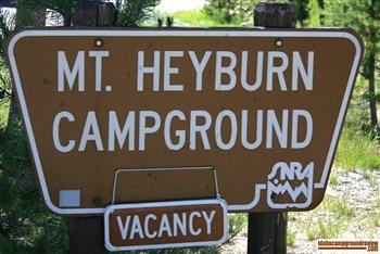
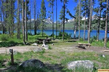
Mt Heyburn Campground
Mt. Heyburn Campground is located on the east side of Redfish Lake on the slope above Sandy Beach Boat Ramp. This are...
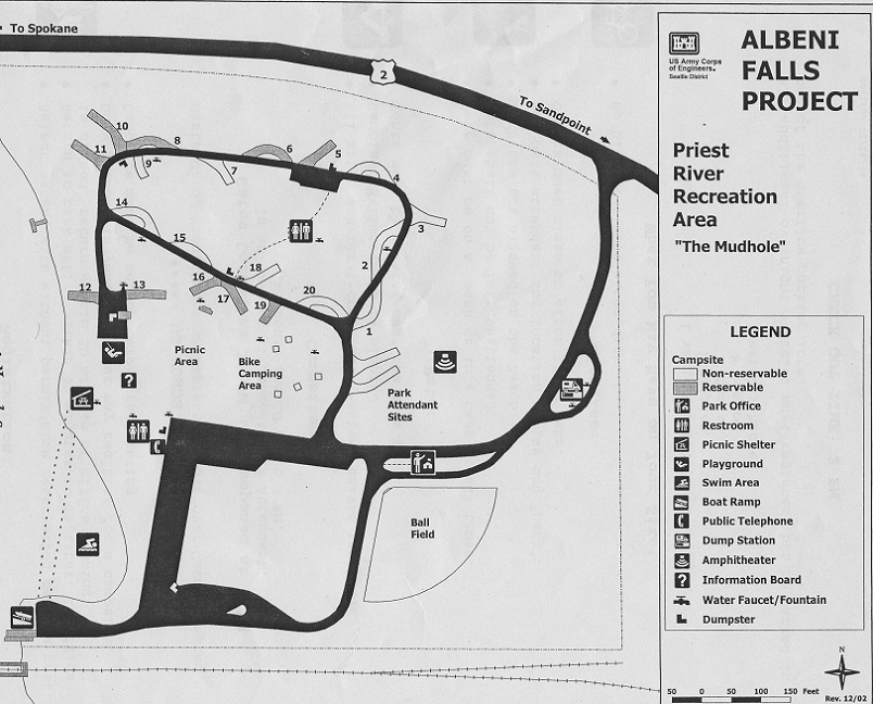
Mudhole Campground
Don't let the name deceive you! Mudhole Campground is in the town of Priest River and is one of the five facilities ...
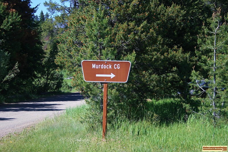
Murdock Campground
Murdock Campground is on flat land where Murdock Creek empties into the North Fork of the Big Wood River. The Boulder...
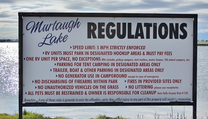
Murtaugh Lake Park
Murtaugh Lake Park is a Twin Falls County park set on a peninsula in Murtaugh Lake. The area around it is farmland wi...
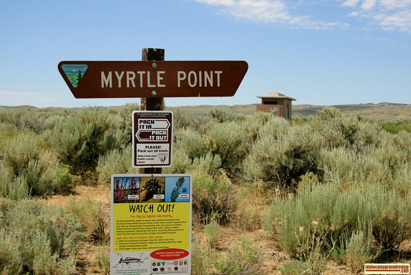
Myrtle Point Campground
Myrtle Point Campground is on Magic Reservoir with one developed campsite. There is a dock laying on the shore but no...