
← All Hiking
Hiking to Imogene Lake from the footbridge at Hell Roaring Lake
📍 43.997902,-114.948738
Imogene Lake is located in the Sawtooth National Recreation Area 15.1 miles south of Stanley, Idaho. The hike from Hell Roaring Trailhead is 8.6 miles and has an elevation gain of 1631 feet. To get directions to Hell Roaring trailhead and a review of the hike to the foot bridge at the outlet stream at Hell Roaring Lake refer to our Hiking to Hell Roaring Lake review.
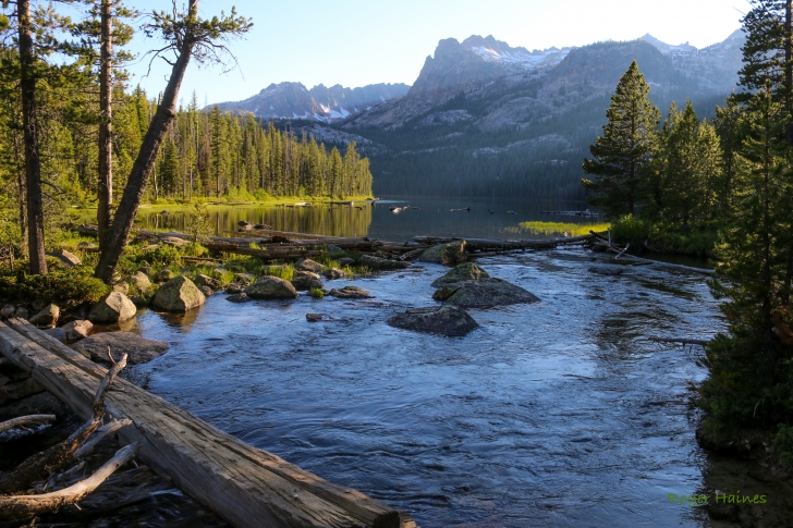
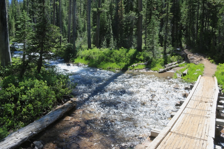
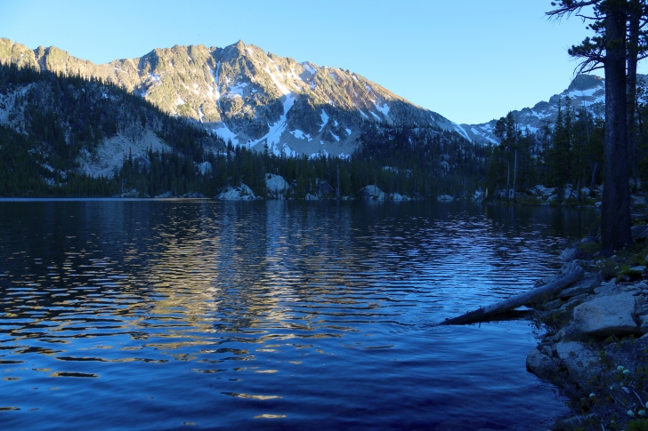
I am starting this review at the foot bridge which crosses Hell Roaring Creek at the outlet to Hell Roaring Lake. You will follow Forest trail 092 to Imogene Lake. Sunset here can be quite beautiful. You will cross the bridge and hike up the eastern shore of the lake.
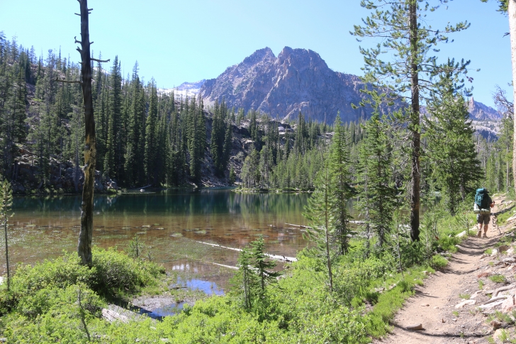
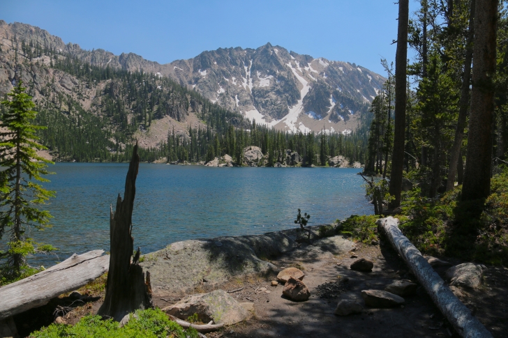
This view of the lake and the Finger of Fate was amazing.
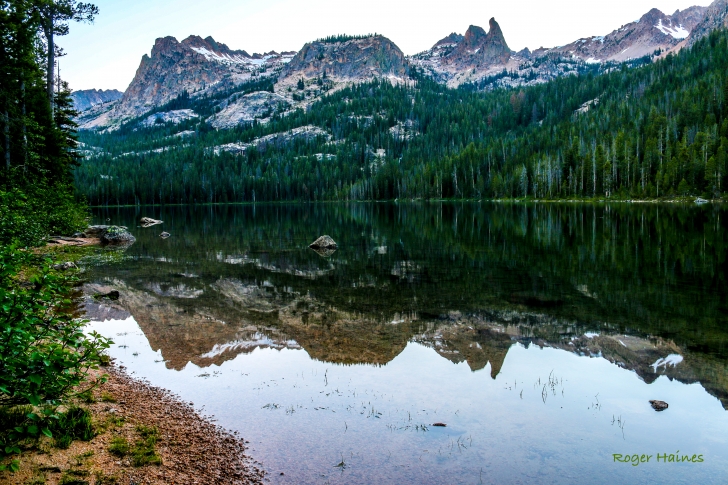
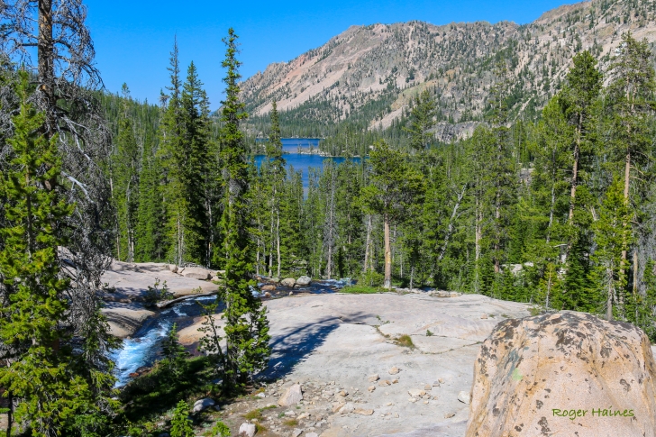
From the foot bridge to the south end of the lake it is about .6 miles. Most of it is dry but there are several marshy spots and a couple small streams.
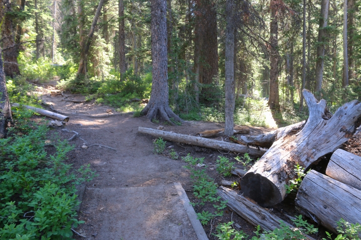
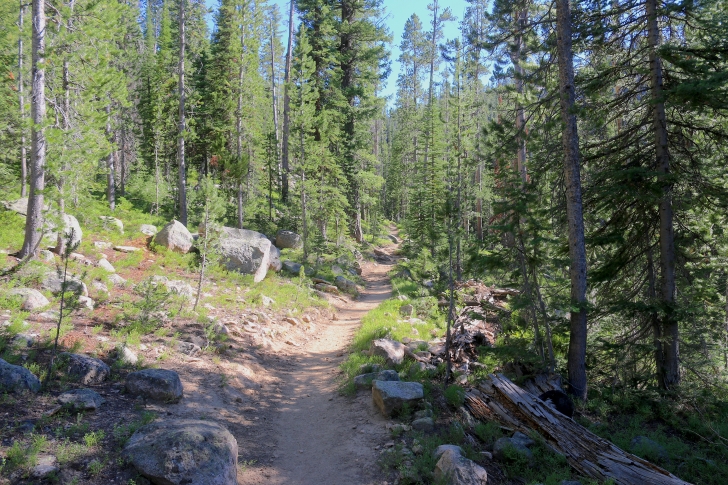
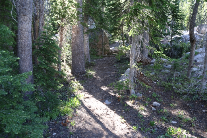
As you can see the main trail(forest trail 092) is well established and maintained. Just beyond the logs on the right there is a trail leading over to the inlet stream.
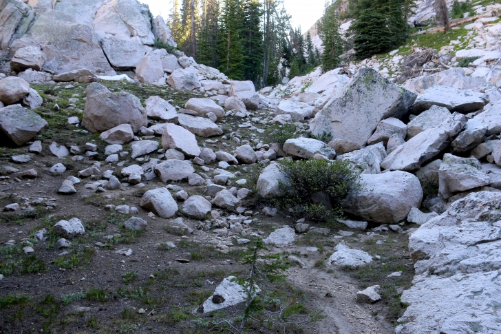
After passing the south end of Hell Roaring Lake the trail climbs for over a mile and gains about 550 feet in elevation.
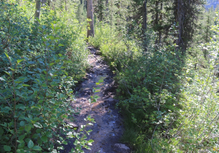
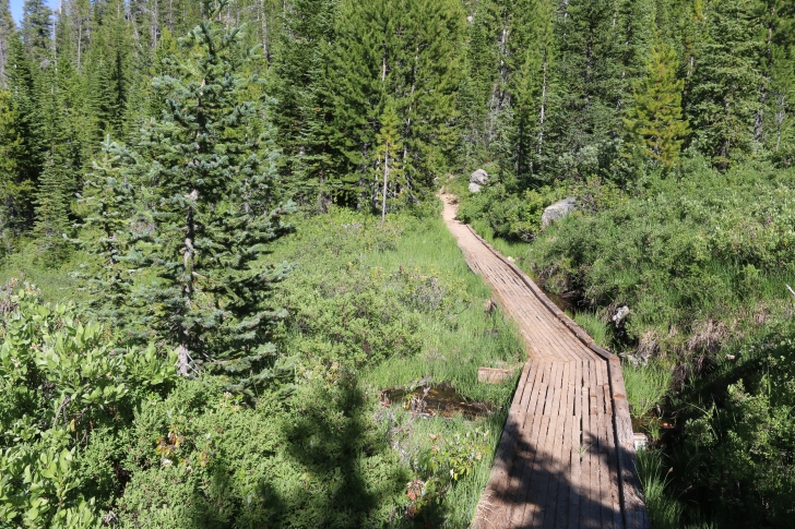
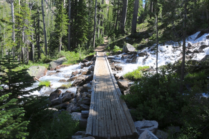
Most of the trail is dry as it climbs but this is one spot where a "bridge" was built.
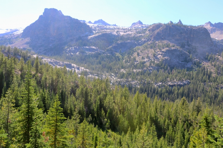
There are several good view points along the trail, this one is looking to the west.
The next mile climbs another 262 feet and brings you to Dolphin Lake. We stopped for water at a small stream about halfway through this stretch, the mosquitos were ferocious but the water was so fresh and cold. Just an FYI, I use a Steripen to sanitize my drinking water. It uses an ultraviolet light to kill any bacteria and is very light weight. I don't feel the need for a filter as the places I like to hike come with clear clean water.
Just above Dolphin Lake the trail crosses the stream on this bridge.
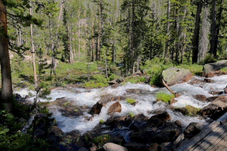
About a half mile after Dolphin Lake you come to this bridge. There is an area below this with multiple streams and falls sadly I was tired and wanted to get to Imogene so I didn't explore it.
Looking down from the trail.
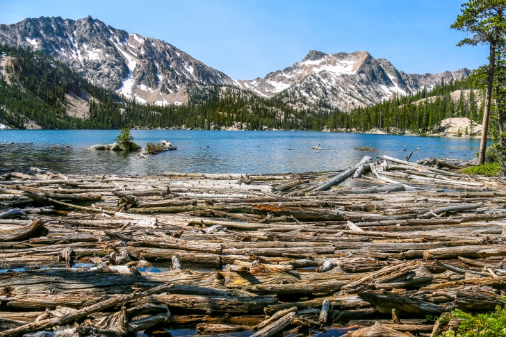
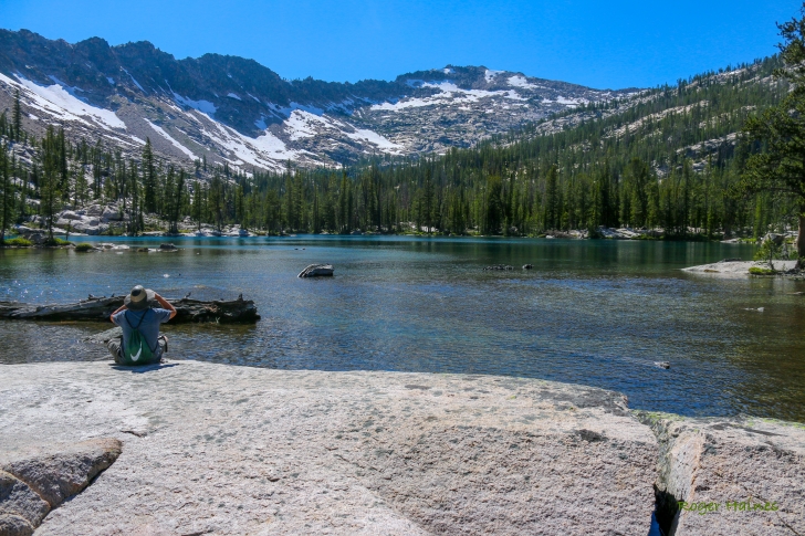
We arrived at Imogene Lake, took a short break and began circling it counter-clockwise. This picture was taken from the logjam at the outlet stream. The logs act as a bridge to access the northern shoreline. That is Imogene Peak on the left.
I took this picture of our campsite which is on trail 397 about .6 miles from the junction with trail 092. I picked it because there is a large rock which slopes into the lake giving us a great spot to lay and look at the scenery.
Our first day at Imogene Lake we hiked to Lucile Lake. There is some amazing scenery on that hike and I will get that review published as soon as I can.
This picture looks south toward the pass one would cross to go to Toxaway Lake.
Our second day at Imogene Lake we hiked southwest on trail 397 along the western shore of Imogene Lake to the inlet stream from Mushroom Lake. We didn't know about this trail which climbs up on the north side of the stream. To find this trail watch to your right as you get close to the stream between Imogene and Mushroom Lakes. We got wet crossing the stream thinking it was the only way up. I will say it was worth it as the waterfall was awesome and there were trout there that were easily 18 inches long.
If you take the trail on the north side of the creek look for this view and climb on up.
The view of Imogene Lake from the outlet of Mushroom Lake. The stream courses over multiple falls on its way to Imogene Lake.
Mushroom Lake with Payette Peak in the far distance. There are several lakes above Mushroom Lake and many small beautiful water falls along the way. I rested here while my son, Kevin, explored them. Someday I will explore them and add to this review.
I like Imogene Lake but found the side trips to Lucile Lake and the Finger of Fate more beautiful. I will be posting those reviews as soon as I am able to.
My son and I spent 5 days hiking near Hell Roaring and Imogene Lakes and found amazing views at every turn. I hope to go back and spend more time to reach some of the higher lakes and maybe catch a few high mountain trout.
Happy Hiking!
This information is accurate as of the date of the review.
← All Hiking