
Hiking
22 trails
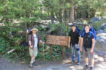
Boulder Lake, Anderson Lake and Rapid Lake Backpack Trip.
It is an easy hike along Boulder Creek Reservoir but starts to climb as you leave the reservoir. There were a lot of ...

Goat Lake and Falls Hike Review
The hike to Goat Lake is approxiamately 4.0 miles with an elevation gain of 1500 feet. I hiked to Goat Lake on a Tue...
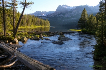
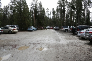
Hike to Alice Lake from Tin Cup Trailhead at Pettit Lake Review
Alice Lake is one of the most visited sites in the Sawtooth Mountains and for good reason. It is one of the most beau...
Hike to Martin and Kelly Lakes on the west edge of the Sawtooth National Recreation Area
Hike to Martin and Kelly Lakes on the west edge of the Sawtooth National Recreation Area
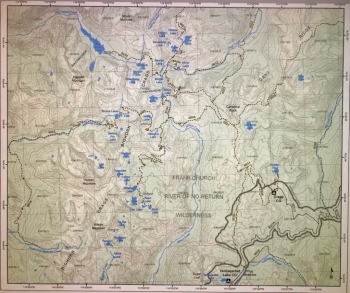
Hiking the Bighorn Crags.
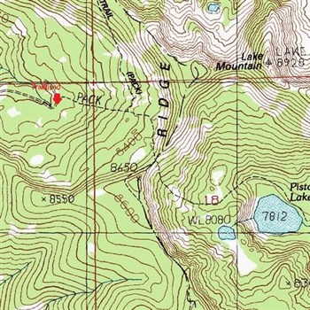
Hiking the trail to Pistol Lake
The hike to Pistol Lake is a little over 1 mile long with an elevation gain of 525 feet and an elevation loss of 700 ...
Hiking to Alpine and Sawtooth Lakes
As I stated on my Goat Lake hike review I did not get pictures of the trailhead itself however these are pictures of ...
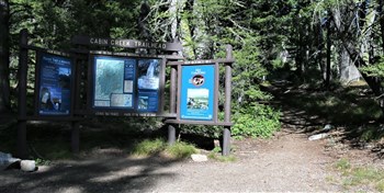
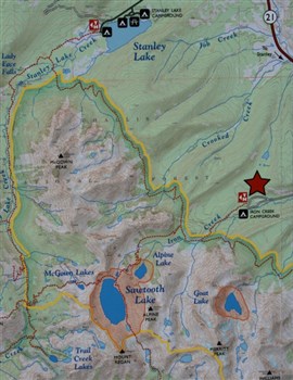
Hiking to Cabin Creek Lakes from Cabin Creek Trailhead
Cabin Creek is located in the Sawtooth Mountains about 20 miles south of Stanley, Idaho. There are five lakes located...
Hiking to Fourth of July And Washington Lakes
The hike to Fourth of July and Washington Lakes in the White Cloud Mountains is one of the easier hikes you'll find. ...
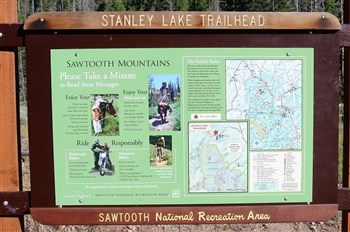
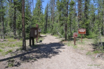
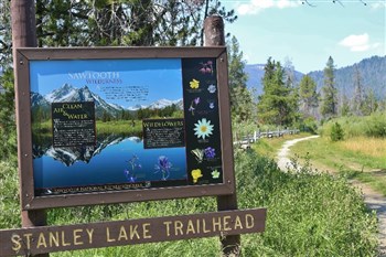
Hiking to Hanson Lakes from Stanley Lake Trailhead
Hanson Lakes are nestled in the mountains on the west side of Stanley Creek above Bridal Veil Falls. There are three ...
Hiking to Hell Roaring Lake
Hell Roaring Lake is located in the Sawtooth Mountains about 13 miles south of Stanley, Idaho as the crow flies. The ...
Hiking to Hidden Lake from Hard Creek Campground.
Hike In Idaho
Hiking to Imogene Lake from the footbridge at Hell Roaring Lake
Hike In Idaho
Hiking to Lava Butte Lakes north of McCall, Idaho.
Hiking to Lava Butte Lakes north of McCall, Idaho.
Hiking to Marshall Lake From the Redfish Trailhead
Hike In Idaho
Hiking to Skein And Raft Lakes
The hike into Skein Lake is just short of 1 mile. The elevation here is 6221 feet. We tried to find this trailhead 2 ...
Hiking to the Bench Lakes by way of the shuttle to Redfish Inlet Trailhead.
I did this 8 mile round trip hike as a day hike and it worked out well however it would be a great backpack destinati...
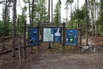
Hiking to Toxaway Lake from the Tin Cup Hikers Trailhead in the Sawtooth Mountains of Idaho.
Hike In Idaho
Hiking Warm Springs Trail #147 from Trailhead near Bull Trout Lake
Hike In Idaho
Lady Face and Bridal Veil Falls hiking trip
August of 2014 I set out on a week of day hikes near Stanley, Idaho. I did 6 hikes in 7 days, the plan was to do 8 hi...
Mores Mountain Trail offers 3 loops: 1 mile, 1.3 miles and 2.1 miles.
We followed the 2.1 mile loop in a clockwise direction and have arranged these pictures in the order we took them. Th...
-cap.jpg)
Review of the hike from Clayburn Trailhead to the Twin and Hard Butte Lakes.
The hike from Clayburn Trailhead to the Twin and Hard Butte Lakes.